Begin typing your search...
Heavy spells predicted for 2 more days
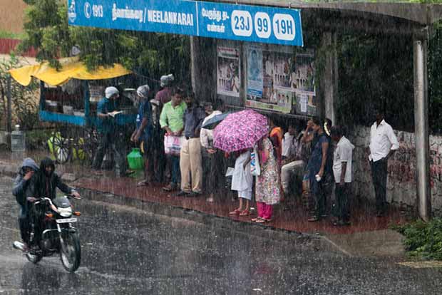
The Regional Meteorological Centre (RMC) has predicted yet another spell of rain for two more days even as moderate to heavy rain lashed the city on Friday morning. However, the activity will be witnessed in isolation in many parts of the city.

Chennai
A low-pressure centered on the Western Ghats along the West Coast is ushering in active monsoon conditions for the last few days. It is now expected to become a depression and provide some heavy spells of rain in the next two days.
Speaking to DT Next, Dr S Balachandran said that a new trough is over the South-West Bay of Bengal off South Sri Lanka coast. “As a result, widespread rainfall activity is likely over Tamil Nadu with many interior places in the state in line for some moderate to heavy thunderstorms for the next two days. These spells are likely to be light to moderate in most parts of the city too,” the weather expert said.
Many areas like Anna Nagar, Koyambedu, Central and North Chennai received moderate showers on Friday morning. “Friday’s rain is likely to kick off what is going to be a very active spell of rains over most parts of Tamil Nadu for the next few days.
A completely scrambled wind pattern at various levels over the state is setting up the stage for some widespread rainfall almost resembling a NorthEast monsoon day instead of South-West monsoon season,” said K Srikanth, a city based weather blogger.
He added that the morning rain was likely over parts of Chennai due to the movement of thunderstorms from the interior areas. Meanwhile, Kancheepuram and Tiruvallur districts recorded heavy rains giving immense inconvenience to the office-goers and school students. Uthiramerur received a maximum of 51 mm of rainfall. Tiruttani and Gummidipoondi too received heavy showers.
Visit news.dtnext.in to explore our interactive epaper!
Download the DT Next app for more exciting features!
Click here for iOS
Click here for Android
Next Story


