
- Chennai
- Election-2026Election-2026
- Tamil Nadu
- National
- World
- Cinema
- Business
- Sports
- Lifestyle
- Technology
- Videos
- Explainers
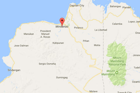
The quake, initially reported as a magnitude 6.0, struck at 5:21 a.m. on Wednesday (2121 GMT on Tuesday). It was very shallow, at a depth of 4 miles (6 km), which would have amplified its effect. Its epicentre was 47 miles (75.5 km) northeast of Cotabato on the large southern island of Mindanao.
A magnitude 5.6 quake is considered moderate and is capable of causing considerable damage.
Visit news.dtnext.in to explore our interactive epaper!
Download the DT Next app for more exciting features!
Click here for iOS
Click here for Android