
- Chennai
- Tamil Nadu
- India
- World
- EntertainmentEntertainment
- Business
- Sports
- Lifestyle
- Technology
- Videos
- Explainers

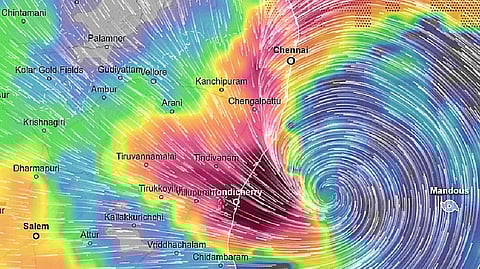
CHENNAI: The Regional Meteorological Centre (RMC) on Wednesday has forecast that the well-marked low pressure has concentrated into a depression and is moving at a speed of 18 km per hour on January 7 and lies centred about 1,140 km from Chennai over the southeast Bay of Bengal and adjoining East Equatorial Indian Ocean.
Further, it will intensify into a Deep Depression during the next 15 hours, the agency said.
Under the influence of the system, a yellow alert was issued for Ramanathapuram, Pudukkottai, Thanjavur, Tiruvarur, Nagapattinam, Cuddalore and Karaikal areas on Thursday and Friday.
Head of RMC Chennai, B Amudha, said, "Between 1891 and 2024, 20 cyclonic disturbances, including depression, cyclonic storm, and severe cyclonic storm, have occurred in January."
According to the weather department, "Light to moderate rain is likely to occur at isolated places over Tamil Nadu at a few places over coastal Tamil Nadu and at isolated places over interior Tamil Nadu and Puducherry areas on January 8."
Orange alert issued for Nagapattinam, Cuddalore, Mayiladuthurai, Tiruvarur and Puducherry areas on January 9 and January 10. "On January 10 and January 11, a yellow alert was issued for Tiruvallur, Chennai, Chengalpattu, Kancheepuram, Ranipet, Vellore, Tiruvannamalai,Villuppuram, Kallakurichi, Cuddalore, Thanjavur and Puducherry," the weather bulletin read.
Squally weather with wind speeds reaching 45 kmph to 55 kmph gusting to 65 kmph is likely to prevail along and off the Tamil Nadu coast, over the Gulf of Mannar and adjoining Comorin area. Sea conditions are likely to be rough to very rough over these areas from January 8 to January 10.
RMC issued a warning for fishermen along the Tamil Nadu coast, advising them not to venture into the mentioned sea area. Those out at deep sea should avoid the southeast and southwest Bay of Bengal and adjoining East Equatorial Indian Ocean, along and off Tamil Nadu-Puducherry-Karaikal coasts during the two-day period.