CHENNAI: Ahead of the strengthening of the northeast monsoon, the Higher Education Institutions (HEIs) in the State, including Anna University, will assist the authorities by providing drones and technical support for relief and rehabilitation efforts during major flood situations.
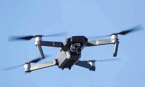
The Centre for Aerospace Research at Anna University, in association with Tamil Nadu Unmanned Aerial Vehicles Corporation, has developed several drones for different sectors, while the Indian Institute of Technology (IIT) Madras has prepared a flood risk map to help track areas in Chennai that are flooded.
In addition to such technical support, students part of the National Social Service (NSS) and National Cadet Corps (NCC), besides other students’ clubs in the institutions, have also been trained to assist the revenue officials who will be engaged in rehabilitation works during the monsoon, said a senior official from the Higher Education Department.
Recalling how the unmanned aerial vehicles (UAVs) developed by Anna University came in handy during the devastating Chennai floods in 2015 and Vardah cyclone in 2016, a senior professor from the institution said that the university has also developed a mobile command and control station to coordinate various disaster relief efforts and rescue operations.
The official added that deemed universities across the State would also join the efforts and assist officials in dealing with the monsoon fury. The technical colleges affiliated to Anna University were also asked to provide the required help during the monsoon period, he added.
Official sources from State Disaster Management Authority and Information Department said the data from the previous floods and supporting pictures were crucial for the response teams during heavy floods.
In recent times, photographs taken using drones are being used during the review and preparedness meetings for government officials who are posted on flood mitigation and relief works.