
- Chennai
- Tamil Nadu
- India
- World
- EntertainmentEntertainment
- Business
- Sports
- Lifestyle
- Technology
- Videos
- Explainers

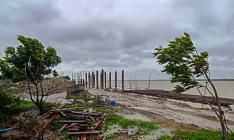
CHENNAI: The National Institute of Ocean Technology (NIOT) is developing a new generation of radar and lidar systems capable of collecting weather data from sea level up to an altitude of 20 km, a move expected to significantly improve the accuracy of marine weather forecasting.
The system is being developed under the Union government’s Mission Mausam, a Rs 2,000-crore programme aimed at strengthening India’s weather and climate observation and prediction capabilities. NIOT plans to conduct initial trials of the new instruments in the open sea by February.
Speaking to DT Next, NIOT Director Prof Balaji Ramakrishnan said the project would help scientists better understand future weather changes using high-quality ocean-based data. He noted that while the India Meteorological Department provides advance warnings to States, damage from extreme weather events cannot be fully prevented due to limitations in available data, particularly from the oceans.
Mission Mausam focuses on collecting large-scale, high-resolution data using advanced technologies and processing it through computer models to deliver faster and more accurate weather forecasts. The project is also expected to support agriculture by providing seasonal rainfall estimates, including forecasts up to three months in advance, which would be of significant benefit to farmers.
With over two decades of experience in ocean observations, NIOT currently deploys moored buoys and drones to collect marine data. Under the new initiative, the institute is designing and manufacturing the radar and lidar systems in-house and developing algorithms to ensure high data accuracy. Laboratory testing is currently under way, followed by sea trials that could extend up to a year, depending on performance.
Prof Ramakrishnan said the project would place NIOT among a select group of institutions globally, noting that only the United States and a few European countries have so far developed radar-based systems on ocean buoys to collect atmospheric data up to 20 km in height.
Once operational, the system is expected to significantly strengthen India’s long-term and short-term weather prediction capabilities using ocean-derived data.
Mission Mausam, led by the Ministry of Earth Sciences, aims to make India a weather-ready and climate-smart nation and position the country as a global leader in weather and climate services.
In the context of the increasing frequency and intensity of extreme weather events such as floods, heatwaves and cyclones, the mission seeks to build a robust forecasting system capable of providing early warnings down to the panchayat level by 2030, thereby improving preparedness and climate resilience.
1. System is being developed under Centre’s Mission Mausam
2. It will measure wind speed and direction, cloud formation, humidity and temperature variations from 10 km to 20 km above the ocean surface
3. Project likely to support agriculture through seasonal rainfall estimates, including forecasts up to three months in advance
4. Initial trials of new instruments in the open sea to be held by February