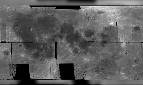
SEOUL: South Korea's unmanned lunar orbiter Danuri has released a comprehensive photographic map of the moon to mark the one-year anniversary of its mission, the science ministry said on Tuesday.
The mosaic map, compiled from polarized camera views captured over the past 250 days, encompasses both the front and back of the moon, according to the Ministry of Science and ICT.
Danuri, also known as the Korea Pathfinder Lunar Orbiter, orbits approximately 100 kilometers above the lunar surface, reports Yonhap news agency.
In addition, the orbiter unveiled images of Tycho, a prominent lunar impact crater located in the southern lunar highlands, while data based on magnetic strengths and gamma rays collected during the one-year mission was also released.
Entering into a selenocentric orbit on December 27 last year, Danuri commenced operations on February 4, about a month after initial test runs.
As South Korea's first space mission beyond Earth's orbit, the orbiter is equipped with six instruments to measure terrain, magnetic strengths, gamma rays and other lunar surface traits.
It is also assigned to identify potential landing sites for the country's future lunar missions.
Originally slated to conclude at the end of this year, Danuri's mission has been extended by two years due to its energy-saving processes.
The orbiter will persist in its operations until December 2025, contributing valuable data to lunar exploration efforts, according to the science ministry.