
Mumbai
Vikas Koli’s wooden boat winds through Mumbai’s maze of creeks, as he looks intently at the map on his phone. The city, India’s financial hub, is a dense urban sprawl home to over 20 million people. On the shore to Koli’s right, concrete slabs rise up from land reclaimed from the creek to build a boat jetty for commuters; upstream, a block of high-rises looms on the horizon. But the map shows none of Mumbai’s modern landmarks. Instead, besides one of the many creeks dividing the megacity, there is a simple illustration of a fishing boat and two crabs.
For Vikas Koli, the map tells the story of a lost past. Conceptualised by urban design studio and think tank Bombay61, it locates points along old coastal fishing villages, or “koliwadas,” which were important sources of fish and crab before the city expanded.
Bombay61 hopes the maps will inspire nostalgia and a greater appreciation of the surrounding environment among locals such as Vikas Koli. Their efforts to foreground livelihoods and natural systems are part of a wider movement of climate activists and urban designers looking to Mumbai’s past for an alternative vision of development.
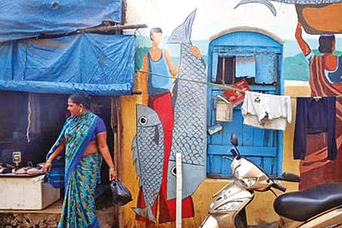
“The water quality was good, some 20 or 30 years ago, and they used to get some fish over here,” Koli remembers, pointing at the crab on the map and the corresponding spot on the riverbank. Said to be the original inhabitants of Mumbai, the Koli community to which he belongs, were traditionally fishermen. Today, they still have a close relationship with the creeks and mangrove forests.
But in recent years, plastic and effluent has polluted the water, damaging both the mangroves and the ecosystems relying on them. The catch has dwindled. “Mumbai used to be owned by the fishermen. But now fishermen are getting displaced,” laments Vikas Koli. “That is the saddest story of Bombay,” he adds, using the former name for Mumbai. Originally a series of islands, Mumbai was built on land reclaimed from the sea during the British colonial era. As the population boomed, competition for space fuelled development projects focused on increasing infrastructure and housing density.
But these have often come at the expense of natural ecosystems — threatening the survival of the city itself. Mumbai floods each year during the heavy monsoon rains, with drainage blocked by dense concrete construction. Encroachment by property developers onto protected mangrove forest land and flood plains have also damaged the city’s natural barriers against storm surges.
Climate change threatens to exacerbate these problems. Sea levels could rise by over a meter (more than 3 feet) before the end of the century, inundating Mumbai and other major coastal cities such as Bangkok, Jakarta and New Orleans, according to a 2019 report from the IPCC. Iqbal Singh Chahal, Mumbai’s municipal commissioner, recently warned that if nothing changes, a large portion of the city would be underwater by 2050.
For Bombay61 co-founder Ketaki Tare, looking to the past is key to facing up to the future. Tare, along with co-founder Jai Bhadgaonkar, hoped that by capturing the community’s memories in maps they could help to reverse what American psychologist Peter Kahn has dubbed “environmental generational amnesia” — where young people normalise their polluted environment. If concrete development, pollution and annual floods become “the new normal,” explains Tare, it is difficult to envision an alternative.
Visit news.dtnext.in to explore our interactive epaper!
Download the DT Next app for more exciting features!
Click here for iOS
Click here for Android