
- Chennai
- Tamil Nadu
- India
- World
- EntertainmentEntertainment
- Business
- Sports
- Lifestyle
- Technology
- Videos
- Explainers
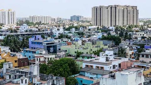
CHENNAI: With the entire Chennai Metropolitan Area (CMA) becoming prone to frequent flooding and water scarcity due to climate change, the Chennai Metropolitan Development Authority (CMDA) has decided to integrate blue-green infrastructure (BGI) in its Third Master Plan.
Under this plan, strategies to improve green cover and the protection of water bodies in the city will be devised. Blue infrastructure refers to water bodies and waterways, while green infrastructure refers to green cover, parks, traffic islands and others in urban planning.
As the CMA is set to be expanded to cover 5,904 sqkm, the CMDA is preparing a vision document to prepare Third Master Plan for the existing CMA (1,189 sqkm) and regional plans for expanded CMA.
According to a CMDA, the city has lost farmlands, floodplains, forests, streams and wetlands due to urban development that increased runoff, reduction of aquifer recharge and increase land surface temperature.
“Climate change projections indicate that Chennai will face greater threats from extreme storm events, pluvial flooding, sea level rise, water scarcity, heat waves, urban heat islands, and poor air quality. Besides, it is to be noted that Chennai’s water risks will aggravate over time unless the natural hydrological flows that sustain the water bodies and aquifers are restored,” the CMDA document said.
Noting that integrating BGI will help CMA build resilience to flooding and other challenges, the planning authority invited consultants to study and prepare a detailed project report for it.
The study will help the planning authority devise strategies for improving green cover, protecting water bodies, sponge development, urban flood risk control, water quality and storage capacity, open space design, sea level protection, shelterbelts, and heat island effect mitigation, among others.
The study will also provide a base for river restoration and management planning, and systematic integration of rivers, canals, ponds, wetlands, flood plains and water treatment facilities.
The document added that the BGI integration will help to fight the issues in the long run even though not immediately.
During the study, consultants appointed by CMDA will map blue and green elements in the metropolitan area and assess climate change risks including sea level rise, heat islands and others.
As part of the study, stakeholders’ meetings will be conducted to collect inputs from vulnerable communities.
Visit news.dtnext.in to explore our interactive epaper!
Download the DT Next app for more exciting features!
Click here for iOS
Click here for Android
